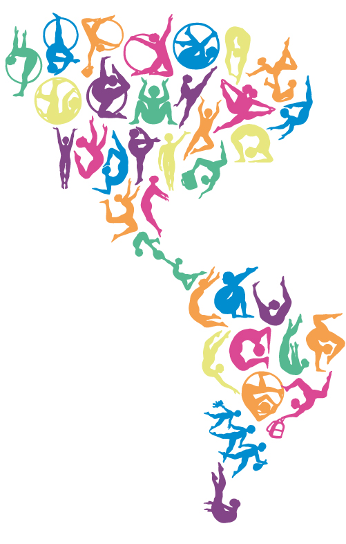
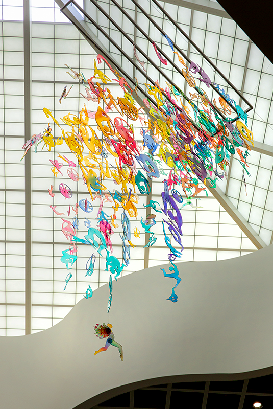
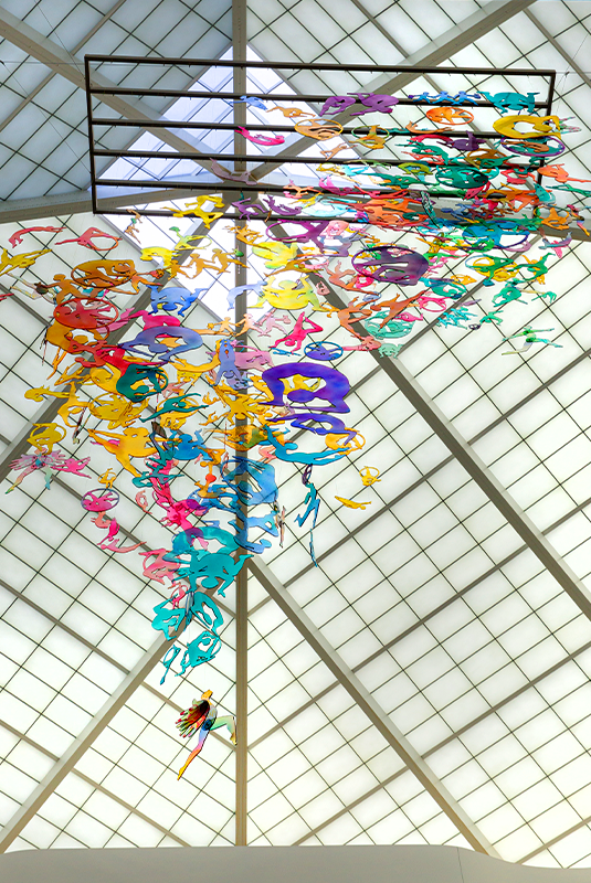
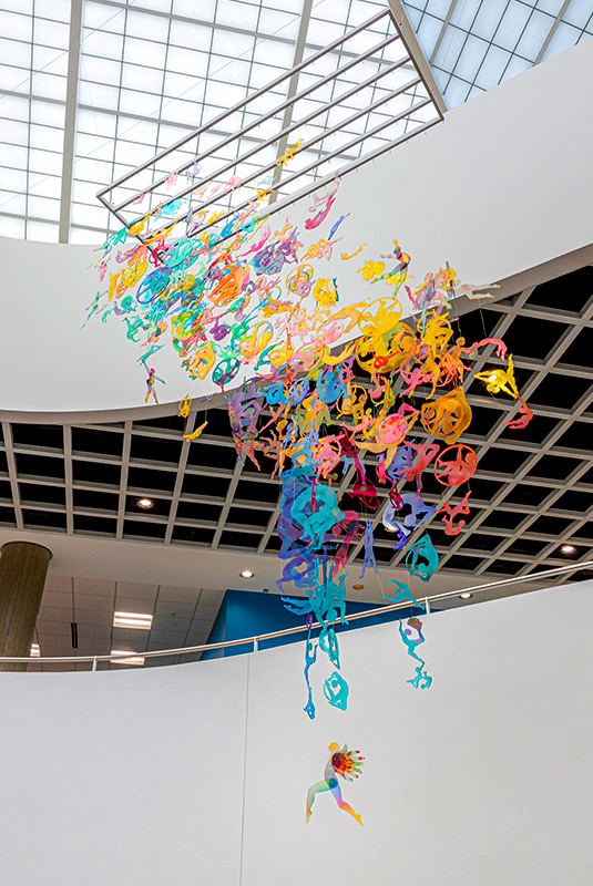
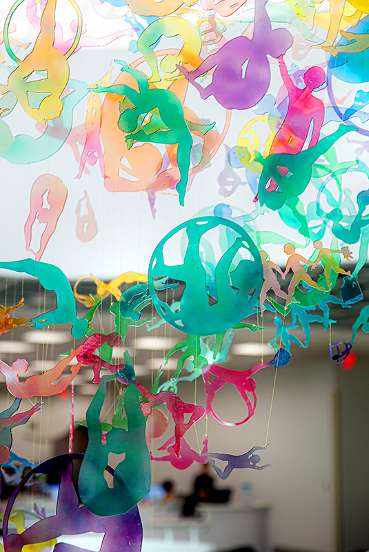
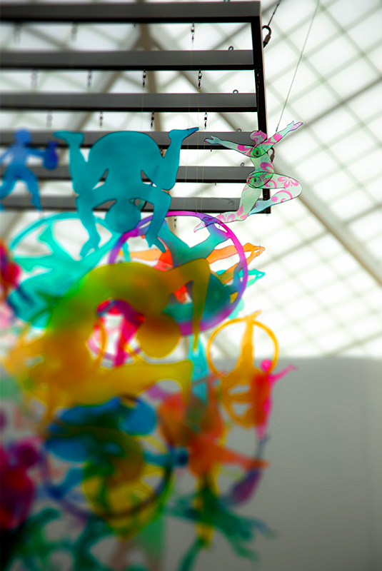
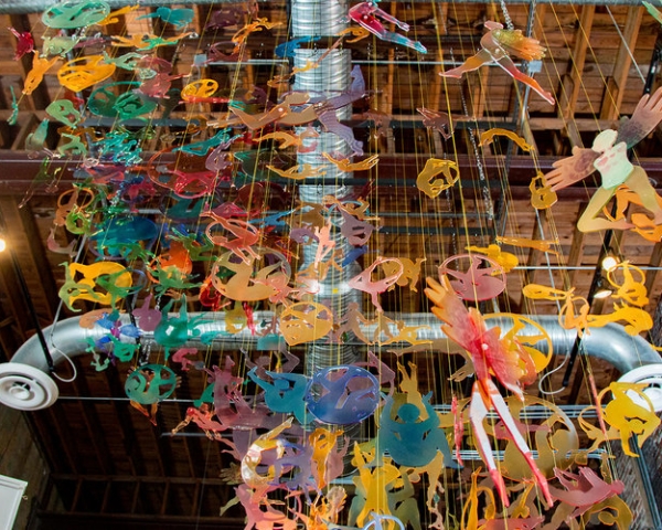
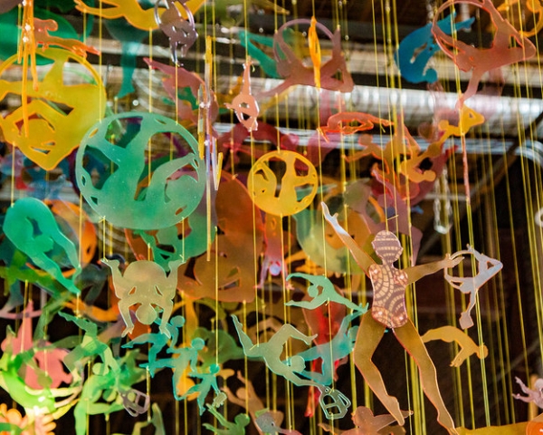
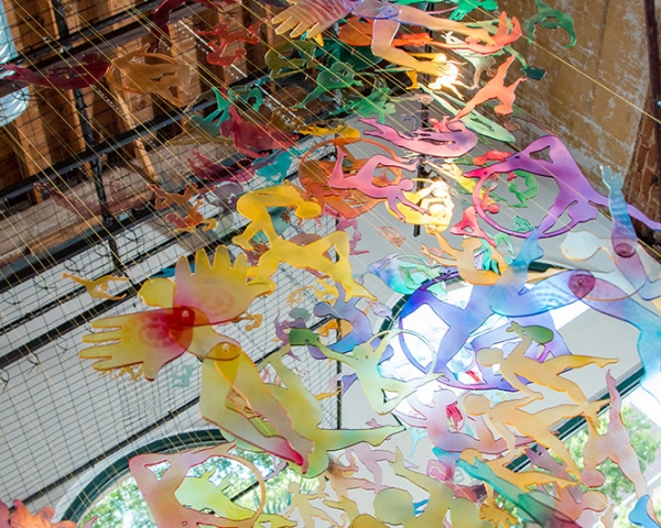
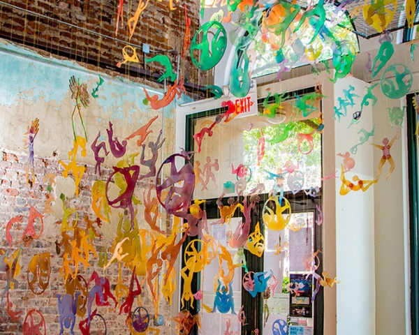
Acrobatic Journeys explores my vision for an ideal society, a vibrant human tapestry woven with mutual respect, collaboration, and shared effort. This three-dimensional piece delves into the interplay of territory, body, and mobility, using suspension, shape, and articulation as its key elements.
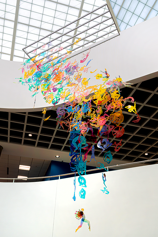
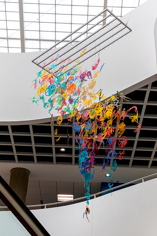
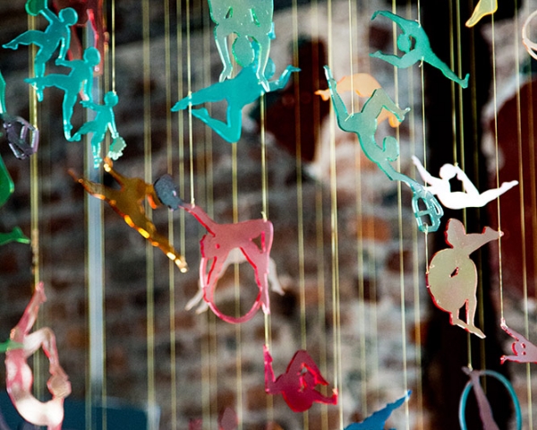
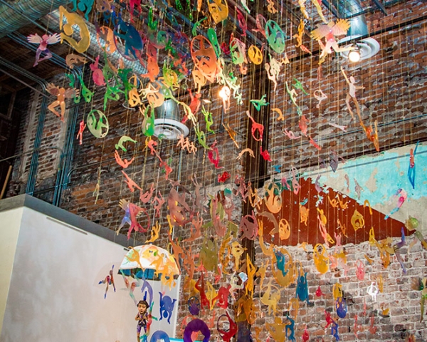
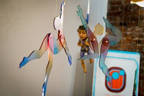
Acrobatic Journeys is a large-dimension installation featuring 400 Plexiglas acrobat figures intricately connected by fishing lines and suspended mid-air to represent North, Central, and South America. Each of the thirty-five acrobat shapes symbolizes a different country and is meticulously repeated on three scales and painted in myriad translucent colors.
The figures in Acrobatic Journeys symbolize people as ‘acrobatic dancers,’ using their bodies as mobility, strength, and direction tools. Their ‘dances’ reflect their wellness, progress, and hope aspirations. Suspended and joined by strings, these acrobats ascend and descend, flowing from side to side, mirroring the geographical dimensions of our interlaced lands. Their journeys become silent choreographies, while their departures and arrivals construct invisible bridges. Individually, each piece is susceptible to fractures, but together, they form a vibrant, robust, and flexible fabric.
These acrobats embody the universal journey we all undertake in seeking happiness. Their breathtaking maneuvers symbolize the resilience required to navigate the physical and emotional barriers that life imposes. As we witness their struggles and triumphs, we are reminded of our own shared experiences, forging a profound sense of empathy and connection. Ultimately, their performance transcends entertainment; it becomes a powerful testament to the human spirit’s unwavering quest for joy and fulfillment, inspiring us to embrace our own challenges with courage and determination.
Acrobatic Journeys
Plexiglass and mixed media
8 x 8 x 8 feet
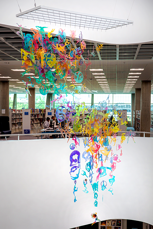
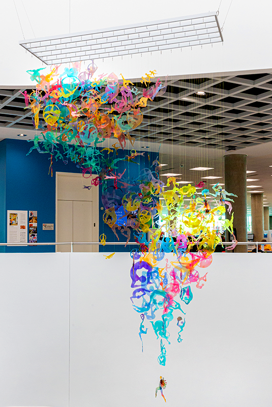
Installation: Richland Library Main, Columbia, South Carolina, USA
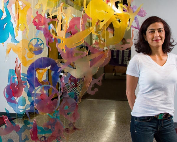
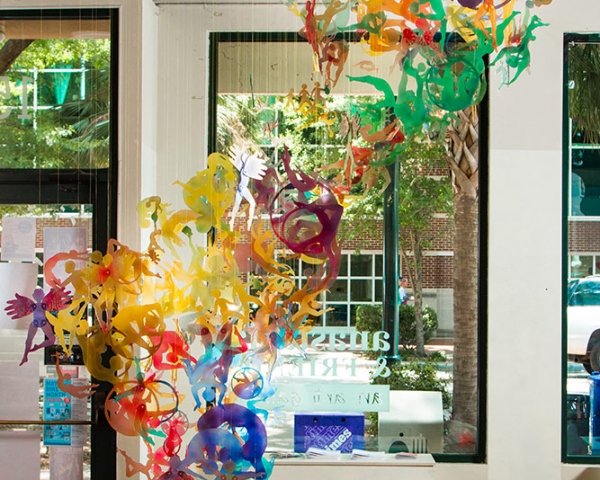
Installation: Free Times Magazine, Columbia, South Carolina, USA.